
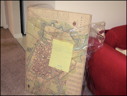
Map of Haarlem in 1822
 When I was in the Netherlands a couple of weeks ago I bought a reproduction of an old map of Haarlem.
In the Haarlem History Museum I found the Kaart van Nautz. The map by Mr. Nautz dates from 1829 and shows the city as it was in 1822.
We had the poster dry mounted by a shop in Durham's Main Street and the result is great. The map is free of wrinkles and very easy to place on the wall.
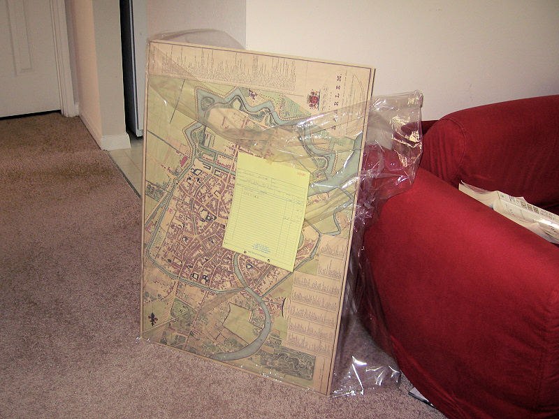
The map is dry mounted against a hard surface, which makes it virtually wrinkle free and very easy to hang nicely on the wall.
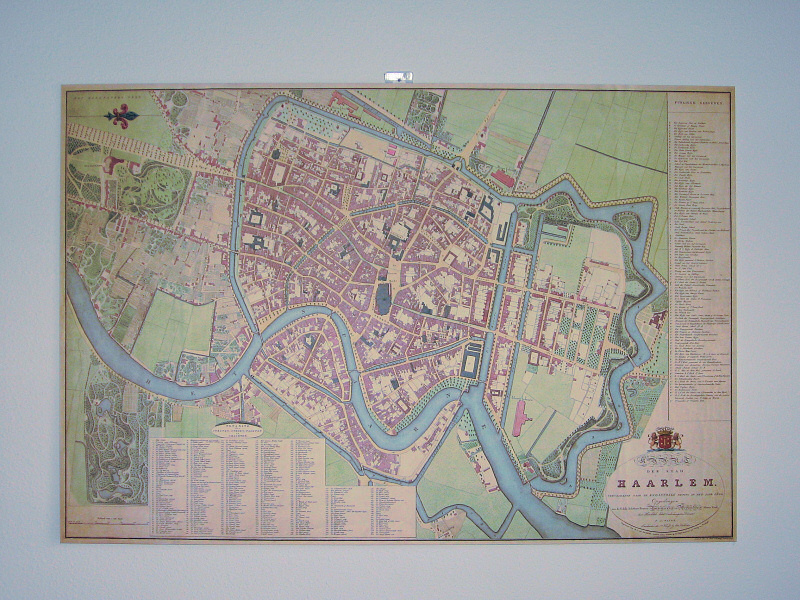
On its place, near the dining table. I want to replace the wall mount with something invisible, I don't like the plastic and nail just above the map too much.
»
- Log in to post comments
Comments
Map of Haarlem in 1822
Wat een mooi exemplaar. Wel grappig dat daar voorheen de belasting aanslag op werd gebaseerd.
Toen wij vertrokken naar hier hebben we er 1 van Schouwenduiveland gehad. Zo leuk om dat nu te hebben inderdaad.
Groetjes Petra
Re: Map of Haarlem in 1822
Mr. Groetjes Petra,
I am writing a thesis, which mentions Haarlem. The city map of Haarlem is very helpful in comparing Haarlem of old time with it in present. Can I use the picture of the map in my thesis? Of course I will footnote the source of the picture(http://www.guusbosman.nl/node/1663). I will appreciate if you reply me soon.
Mathilda Wu
Re: Map of Haarlem in 1822
Hi Mathilda,
Yes, no problem. Good luck with your thesis.
Best regards,
Guus
Map of Haarlem in 1822
Stop buying memorial stuff. It's no shame to come back home ;-)
Arjan.