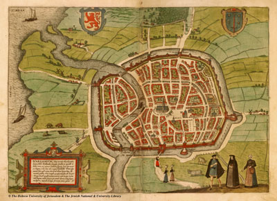
Map of Haarlem
 I found a beautiful historic map of Haarlem online.
The map is from 1575 and was created by Braun and Hogenberg, for the atlas Civitates Orbis Terrarum.
This was the way the city looked like when it was under siege by the Spaniards.
In the lower left corner of the map you can see the Catharijnebrug, the bridge that is close to our house now (opposite the policestation). On the map that is the end of the city, before the city gates. The Hooimarkt became part of the city much later.
»
- Log in to post comments


Comments
Map of Haarlem
Ha op http://home.planet.nl/~marcel.tettero/tette/Spaarn.html een view vanuit je woning