 A nice tool that I recently tried out is Google Maps.
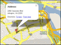
If you type in an American address in the Google search bar, you're given the option to see a map of that address. Of course I tried it immediately with our own address.
The main thing I like about it is that you can zoom in & out, and so get a good idea of the entire area. In the map of our address, you can see the Iwo Jima monument that I saw last week. In the lower-left corner is Quincy park, that's where our library is (about 25 minutes walking).
In the shadow of the address sign is the location of my work (at the crossing of Wilson Boulevard with the Fort Myer drive). The bridge of the river is the Key bridge, that leads to Georgetown and downtown D.C.
If you move the focus a bit, or zoom out, you can see Washington D.C. Another thing I tried was following the river, the Potomac from its beginning to the Atlantic ocean.


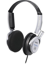 Sasha gave a me a very nice present for Christmas: noise-cancelling headphones!
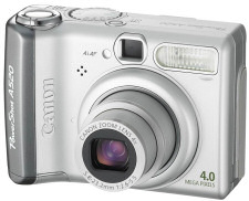 We have a new camera!
 Joris pointed me out to a really cool new tool by Google: the Google Desktop. It's a search-engine that you works for your own computer, so locally.
 A simple but beautiful